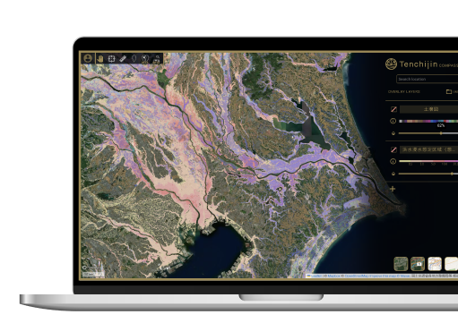
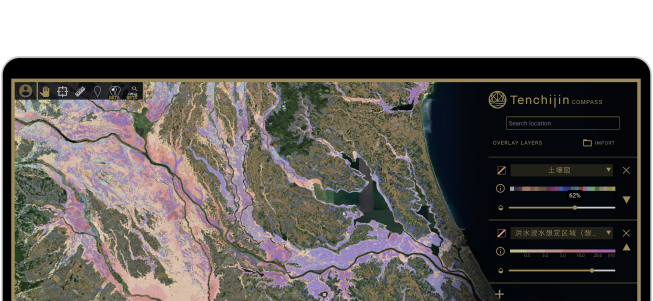
Tenchijin COMPASS arranges the most suitable satellite images, considering factors such as image type, timing of observation, resolution, coverage, and the number of images, based on your objectives.


One step further
from outer space
A digital globe that accelerates
business decision-making.
Tenchijin COMPASS is an online GIS platform
that harnesses satellite Big Data to solve global issues.
Already have an account?
Login
Search and find the optimal location for
your business with our Smart Data-driven, AI powered propietary algorithms.






Register now for full access!
Tenchijin COMPASS Features

Unparalleled speed
Faster discovery of optimum land
for your business.

Well-informed and accurate deciscion-making
Low-cost, data-driven
decision-making.
Cost Effective
Sustainable, labor
cost-sving business tool.

Designed for teamwork
Specialist not required.
Collaborate with your team.
Ready to use straight out of the box.

Combine your data
with satellite data
Upgrade algorithms by combining
your own information/data
to existing space big data.
Tenchijin COMPASS is a free online GIS platform.
Try it out first.
What Tenchijin COMPASS can do
I want to find new places to cultivate crop to adapt to climate change
Tenchijin COMPASS, with its similarity analysis function,
can solve your problem.
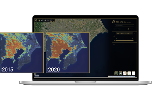
For example, Tenchijin COMPASS can visually compare land surface temperatures between 2015 and 2020, allowing users to easily assess the impact of global warming. This technology can be utilized to visualize the shifts in suitable lands for cultivation within a country due to climate change.
I want to make infrastructure maintenance more efficient by using objective data in larger areas.
Tenchijin COMPASS, with its user-friendly browser-based GIS
and unique algorithms, can solve your problem.
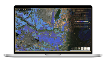
Anyone can use Tenchijin COMPASS by simply logging in. The online GIS is intuitive and easy to use. Tenchijin COMPASS can analyze multiple datasets with its original algorithm, making it possible to assess the risk of infrastructure structures that are affected by multiple and complicated factors.
I want to expand
my business overseas.
(Agriculture, energy, decarbonization, urban development)
Tenchijin COMPASS provides historical weather
and environmental information worldwide to solve
your problem.
Business is becoming more globalized, and climate change is becoming a global issue. Tenchijin COMPASS, with its features to visualize weather data from around the world, enables cross-border land assessments. There is no longer a need to obtain information from each national meteorological agency. Tenchijin COMPASS is intuitive for users of all levels.
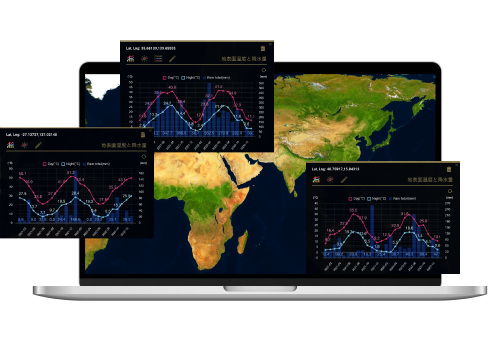
Tenchijin COMPASS is intuitive for users of all levels.
Start using Tenchijin COMPASS in
3 SIMPLE STEPS!
STEP 1
STEP 2
STEP 3

STEP 1
Register an account (free)
Register your email address and basic
information by simply following the
guidelines.

STEP 2
Confirm your email address
Check your email at the address you
entered. Click on the verification link.

STEP 3
Log in and start
Try out all the features
Tenchijin COMPASS has to offer.
*The free-version
will always remain free.
Tenchijin COMPASS is a free online GIS platform.
Try it out first.
With the paid version of Tenchijin COMPASS
Collaborate with
your team
Upload client
information
Develop and use
algorithms
tailored to clients
For example
Case studies of the paid-version
Water Supply Infrastructure Management
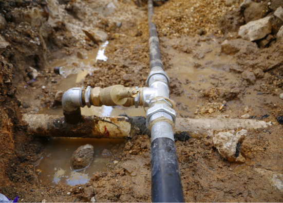
Currently, approximately 17.6% of water pipelines in Japan (with a total length of 130,000 km) have exceeded their legal durability. Therefore, efficient inspection, maintenance, and repair are required. Tenchijin COMPASS enhances infrastructure management efficiency with its unique leakage risk assessment system, achieving up to a 65% reduction in inspection costs and an 85% reduction in survey time.
Agriculture

In agriculture, high temperatures resulting from global warming are damaging crops, and the number of farmers is decreasing. Tenchijin COMPASS provides data-driven cultivation land selection and management services for rice, fruit trees, vegetables, and other crops based on client requests, eliminating the need for intuition or excessive labor. In 2022, our "Space Big Data Rice" (rice grown using this technology) won the Space Utilization Grand Prize awarded by the Japanese Minister of Agriculture, Forestry, and Fisheries.
Renewable Energy
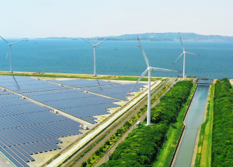
In the renewable energy sector, competition to secure suitable land for developing renewable energy projects is intensifying both domestically and internationally. In the pursuit of suitable land for renewable energy farming, Tenchijin COMPASS facilitates speedy decision-making by comprehensively utilizing and analyzing various information sources, such as map data, weather information, and aerial and satellite imagery.
Q&A
Tenchijin COMPASS, which visualizes insights derived from satellite data, enables you to read and interpret them without requiring specialized knowledge.
Tenchijin COMPASS provides cost-effective services tailored to your budget and objectives, utilizing free data released by various national space agencies as well as commercial satellites.
Tenchijin COMPASS does not require any specialized software and is available at a relatively low cost since it is a web-based service.
No, you don't need a specialist because Tenchijin COMPASS is designed to be user-friendly for everyone. We encourage you to give it a try first!
Tenchijin COMPASS is a free online GIS platform.
Try it out first.
AWARDS







MEDIA















Anyone can start utilizing various satellite data with Tenchijin COMPASS simply by creating an account.